
Executive Summary
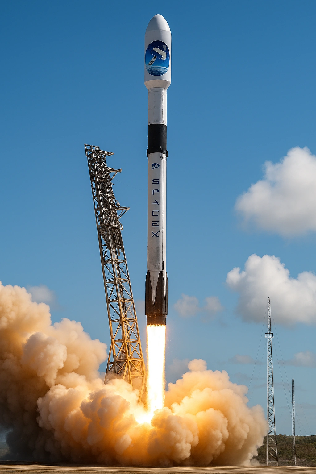
The successful deployment of Sentinel-6B aboard a Falcon 9 rocket represents far more than SpaceX’s 500th mission milestone. This launch exemplifies the convergence of two revolutionary paradigms: the democratization of space access through commercial innovation and the evolution of climate science into a real-time, data-intensive discipline. This paper examines the technical, scientific, and strategic implications of this mission for NASA’s future Earth observation architecture.
1. Mission Overview: Beyond the Headlines
1.1 Launch Parameters
Launch Vehicle: Falcon 9 Block 5 (flight-proven booster)
Launch Site: Vandenberg Space Force Base, California
Orbit: Low Earth Orbit (LEO), ~1,336 km altitude
Payload Mass: ~1,440 kg
Mission Partners: ESA, NASA, NOAA, EUMETSAT
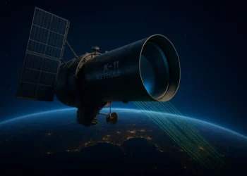
Primary Instrument: Poseidon-4 SAR Altimeter
1.2 Strategic Context
Sentinel-6B continues the critical Jason/Sentinel series legacy, ensuring uninterrupted sea-level measurements since 1992—the longest continuous climate data record from space. This 30+ year dataset is irreplaceable for detecting long-term climate trends amid natural variability.
2. Technical Innovation: The Poseidon-4 Advantage
2.1 Synthetic Aperture Radar Revolution
Traditional radar altimeters measure sea level with ~10 km footprints, creating “blind zones” near coastlines and ice edges. Sentinel-6B’s Poseidon-4 introduces dual-mode operation:
Low-Resolution Mode (LRM):
Maintains continuity with historical Jason missions
~10 km footprint
Ensures long-term climate record consistency
High-Resolution SAR Mode:
~300 m along-track resolution
Improved coastal measurements (critical for 40% of global population)
Enhanced performance over sea ice and inland water bodies
Reduced noise in wave height measurements
2.2 Measurement Precision
Sea surface height accuracy: ±3 cm (global average)
Coastal zone accuracy: ±5 cm (within 5 km of shore)
Wave height precision: ±0.25 m
Temporal resolution: Global coverage every 10 days
Impact: This precision enables detection of regional sea-level variations associated with ocean currents, eddies, and climate oscillations (ENSO, NAO) that are invisible to lower-resolution systems.
3. The SpaceX Factor: 500 Missions and Counting
3.1 Statistical Performance Analysis
| Metric | Falcon 9 | Traditional Expendable |
|---|---|---|
| Success Rate | 98.5% (500 missions) | 95–97% |
| Cost per Launch | $28–30M (reused) | $150–200M |
| Turnaround Time | <48 hours (theoretical) | N/A |
| Booster Reuse Record | 20+ flights | 0 |
| Annual Launch Cadence | 90+ (2024) | 10–15 |
3.2 Vertical Integration as Competitive Advantage
SpaceX’s manufacturing model represents a paradigm shift:
In-house production: Merlin engines, avionics, flight software, ground systems
Production rate: 2–3 Falcon 9 cores per month
Engine production: 2,000+ Merlin engines delivered since 2006
Software autonomy: Autonomous flight termination, landing algorithms
NASA Relevance: This model challenges traditional aerospace procurement. Future NASA missions can leverage commercial cadence for constellation deployment, reducing mission risk through rapid replacement capability.
4. Earth Observation in the Data Deluge Era
4.1 The Big Data Challenge
Sentinel-6B generates ~15 TB of raw data daily, joining a growing constellation:
Current Operational Assets:
Sentinel-6A Michael Freilich
Jason-3
SWOT
Sentinel-3 series
Near-Future Missions:
CRISTAL (2028)
NISAR (2024)
Additional Sentinel-6 follow-ons
4.2 From Measurement to Intelligence
Computational Requirements:
Petabyte-scale cloud processing
Integration with ECMWF, NOAA, NASA models
AI/ML for pattern detection & predictive analytics
Emerging Capability: Near-real-time ocean state estimation for:
Hurricane intensity forecasting
Maritime route optimization
Coastal flood early warnings
5. Strategic Implications for NASA
5.1 The Commercial Launch Advantage
Cost-Benefit Analysis:
Traditional: Single flagship satellite, $500M+
Emerging: Distributed constellations, rapid refresh cycles
Risk Mitigation:
Spare-satellite strategy
On-orbit replacement within months
5.2 International Collaboration Model
Sentinel-6 demonstrates successful multi-agency cooperation:
ESA: Satellite procurement
NASA: Instruments & launch
NOAA: Operational use
EUMETSAT: Data distribution
All Sentinel-6 data are freely available within 3 hours of acquisition.
5.3 Future Architecture Considerations
Mega-Constellation Vision:
Current: 2–3 altimetry satellites (10-day coverage)
Future: 10–20 satellites (daily coverage)
Technology Roadmap:
CubeSat altimeters
AI edge computing
Inter-satellite links
6. Climate Science Impact: 2025–2035 Projection
6.1 Sea-Level Rise Monitoring Enhancement
Current Capability:
±0.3 mm/year uncertainty
Enhanced by Sentinel-6A/B:
±0.2 mm/year
Regional detection at 10–50 km scales
Reliable coastal measurements within 5 km
Human Impact:
680M people in coastal zones
Improved local projections
Billions saved in adaptation costs
6.2 Integration with IPCC Cycles
Supports:
IPCC AR7 (2027–2028)
SROCC updates
US National Climate Assessment
Key questions include:
Antarctic ice sheet loss
AMOC weakening
Sediment & subsidence interactions
7. Challenges and Considerations
7.1 Data Governance in the Commercial Era
Key concerns:
Data access equity
Continuity if commercial providers exit
High-resolution imaging regulation
7.2 Computational Equity
Climate data requires:
HPC infrastructure
ML expertise
High-bandwidth networks
Risk: Developing nations lag behind.
Mitigation: NASA ARSET and global training efforts.
8. Conclusions and Recommendations
8.1 Key Findings
Sentinel-6B marks operational maturity of SAR altimetry.
SpaceX’s 500 missions redefine reliability economics.
Low-cost launch + advanced sensors = transformative architectures.
Big data demands global standards & infrastructure.
8.2 Recommendations for NASA
Near-Term:
Study distributed constellations
Expand AI/ML integration
Strengthen NOAA partnerships
Mid-Term:
CubeSat altimetry demo
Cloud processing alliances
International working group
Long-Term:
Mega-constellations
Cislunar comms networks
Real-time climate forecasting
9. Concluding Perspective
The Sentinel-6B launch is a watershed moment—not merely for achieving a numerical milestone, but for demonstrating that the barriers to continuous, high-fidelity Earth observation are dissolving.
In the Apollo era, we went to the Moon.
In the Sentinel era, we finally learn to see Earth with unprecedented clarity.
The partnership between global space agencies and commercial innovators like SpaceX is forging a new golden age of climate science—one defined not by data scarcity, but by analytical opportunity.
The question is no longer whether we can observe our changing planet—but whether we will act on the data in time.
References
- ESA Sentinel-6 Mission Requirements Document (2023)
- SpaceX Launch Manifest and Reliability Statistics (2024)
- IPCC AR6 WG1: Sea Level Rise Projections (2021)
- NASA Earth Science Decadal Survey (2017)
- NOAA Laboratory for Satellite Altimetry Technical Reports
- Nature Climate Change: Special Issue on Satellite Altimetry (2023)
- EUMETSAT Poseidon-4 Instrument Performance Analysis (2024)

